la Nina rears her ugly head

La Niña Rain Gage
Nothin'/Skunked-Foggy Doggy-Play Misty-Drizzle Corn-Light Showers-Steady Soaker-Bands/Sheets-Cats & ***********************************************************************************:)
 
Last 6 days we have had about 50% of our season average. :oop:
 
La Niña Rain Gage
Nothin'/Skunked-Foggy Doggy-Play Misty-Drizzle Corn-Light Showers-Steady Soaker-Bands/Sheets-Cats & *****************************************************************************************************:)
 
Came down really heavy around here last night as well. we are .81 inches short of 200% or our annual total rainfall. (y)
:giggle:⚡
 
Tiny sharp hail (like frozen razor blades) falling sideways from gusty winds trying to flip me over a few times, and actually pushing me over a whole lane and a half as I crossed the top of the bridge over the canals on 28th at the south end of Metrocenter, for more than several minutes on my way home from work today, then teh winds died down and it turned to drizzle, then rain (is still raining).
 
Is pouring rain now and has been for a couple hours or more (had been going pretty good before that, but really dumped in this time). I think we have had over an inch today but the stations near me are either down or not recording precip. The yard is soaked with lakes in it, and the street is overflowing still, though I can see the crown in the middle and the sidewalks aren't covered.

This page
https://www.wrh.noaa.gov/map/?&zoom...radar_min=20&radar_loop=true&radar_opacity=70
has a precip chart with a six hour total of 0.66" for my area, depending on where I click near my house, but I don't know the data source since I can't find an actual station with publicly available data that has been up and running.

Has dropped to the low 40sF already at a bit before 9pm, and forecast actually says we may get snow after midnight, snowline down to 3000F here. (was predicted as 2500F earlier). (ground here is at around 1100F, IIRC).
 
Last edited:

Detailed Forecast​

Tonight
A chance of snow showers before 10pm. Areas of frost after 10pm. Otherwise, mostly clear, with a low around 31. Light and variable wind becoming south 5 to 10 mph in the evening. Chance of precipitation is 30%. Little or no snow accumulation expected.
Thursday
Sunny, with a high near 56. South wind around 5 mph becoming calm.
Thursday Night
Patchy frost after 10pm. Otherwise, mostly clear, with a low around 36. Calm wind becoming northeast around 5 mph.
Friday
Sunny, with a high near 60. Calm wind becoming northwest around 5 mph.
Friday Night
Mostly clear, with a low around 38. Northeast wind around 5 mph becoming calm.
Saturday
Sunny, with a high near 59.
Saturday Night
Mostly cloudy, with a low around 38.
Sunday
Partly sunny, with a high near 56.
Sunday Night
Patchy fog after 10pm. Otherwise, mostly cloudy, with a low around 38.
Monday
Partly sunny, with a high near 56.
Monday Night
Mostly cloudy, with a low around 36.
Tuesday
Mostly sunny, with a high near 58.
Tuesday Night
Partly cloudy, with a low around 37.
Wednesday
Mostly sunny, with a high near 61.
 
California was low on water before these storms, this is where we are now.....California Res Mar 2 2023.jpg
 
I used to hear about this storm from old timers at work. I remember snow like we just got around 1984, but this 1938 storm was before the post war development and flood control improvements.
 
I got just about 1.0" over the last two days. Nothing heavy, but it just keeps coming down. Now they're saying another Atmospheric River is forming and headed our way. 7-Day precip forecast is looking pretty serious for some places in the Sierras. Warm rain on top of snow will result in heavy runoff and flooding.

1678172979568.png
 
QPF estimates have gone up since yesterday. Don't put away that umbrella yet. Maybe get out the kayak. Now showing about 5" here over the next week.

Maybe they will finally quit whining about the drought.
 
Not a chance. The California reservoirs are only at historic averages if not below. Then there is the lake Mead problem. We will see what the snow melt brings.
 

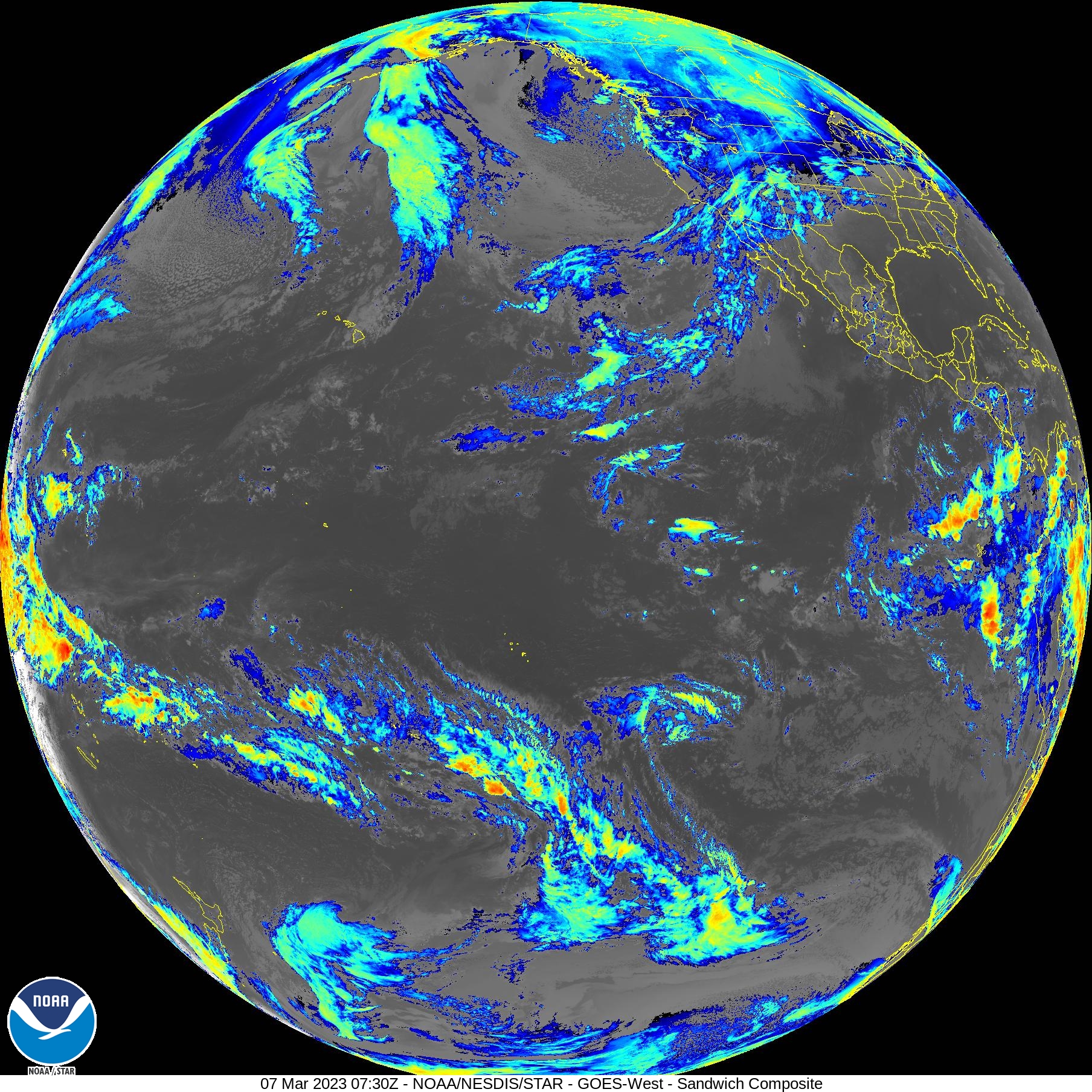
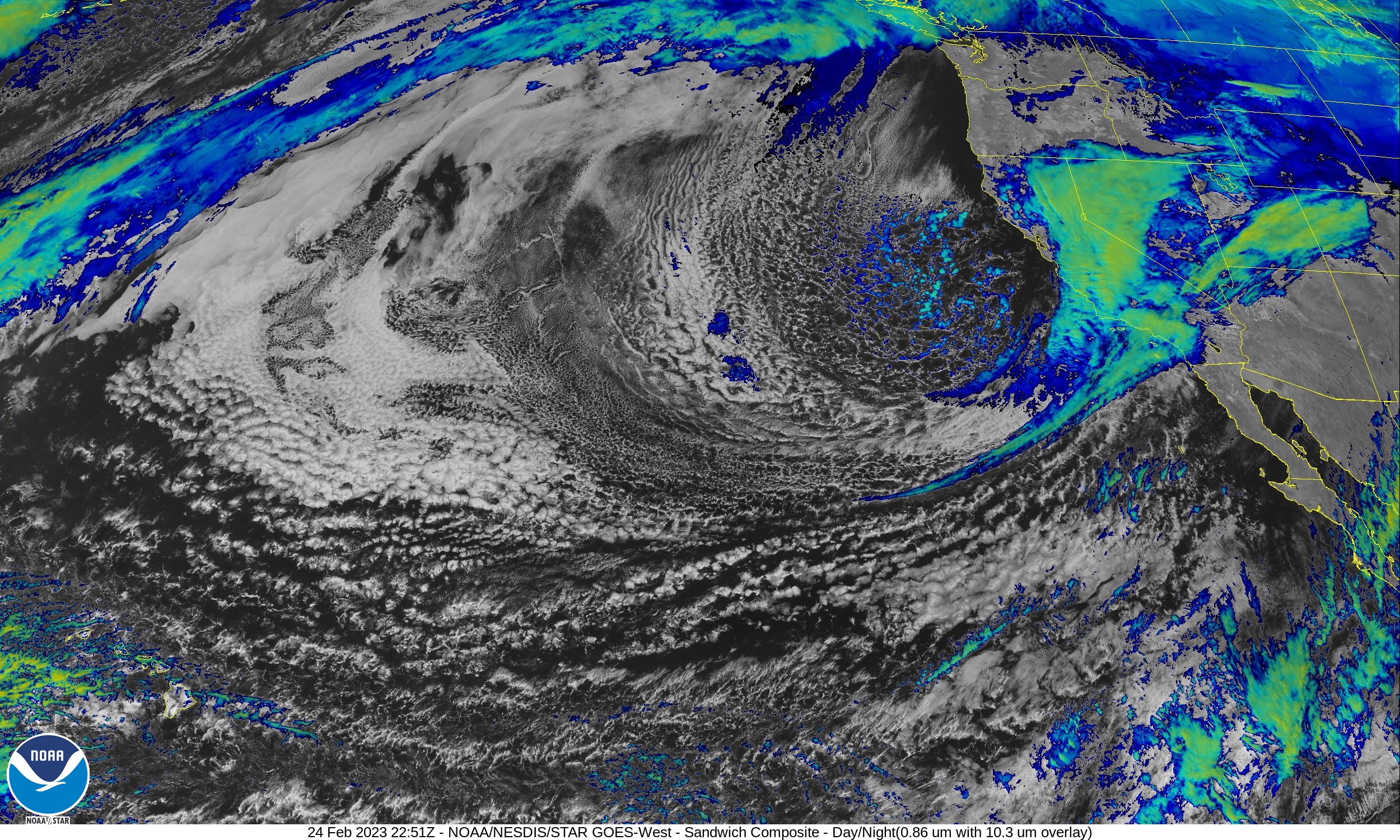
Satellite view of the classic Pineapple Express:​

Detailed Forecast​

Tonight
A slight chance of rain after 4am. Increasing clouds, with a low around 48. Southwest wind around 5 mph becoming calm in the evening. Chance of precipitation is 10%.
Friday
Rain, mainly after 10am. High near 59. Calm wind becoming southwest around 5 mph. Chance of precipitation is 80%. New precipitation amounts between a tenth and quarter of an inch possible.
Friday Night
Rain, mainly before 4am. Low around 50. South wind around 5 mph becoming calm. Chance of precipitation is 80%. New precipitation amounts between a quarter and half of an inch possible.
Saturday
A chance of rain before 10am. Mostly cloudy, with a high near 64. Light and variable wind becoming southwest 5 to 10 mph in the afternoon. Chance of precipitation is 40%. New precipitation amounts of less than a tenth of an inch possible.
Saturday Night
Mostly cloudy, with a low around 50. Southwest wind around 5 mph becoming calm after midnight.
Sunday
Partly sunny, with a high near 66.
Sunday Night
Mostly cloudy, with a low around 48.
Monday
Mostly sunny, with a high near 70.
Monday Night
A slight chance of rain after 10pm. Mostly cloudy, with a low around 50.
Tuesday
A chance of rain. Mostly cloudy, with a high near 66.
Tuesday Night
A chance of rain. Mostly cloudy, with a low around 48.
Wednesday
A chance of rain. Partly sunny, with a high near 61.
Wednesday Night
A chance of rain. Mostly cloudy, with a low around 45.
Thursday
A slight chance of rain. Mostly sunny, with a high near 63.
 
Last edited:
Coming down pretty good here now. At least the cars will get washed off. The 7-day precip map looks scary for parts of the Sierras. 10" of rain is a lot. And that's a pretty large area, so a lot of water has to go somewhere. Too bad it's not into Lake Mead or someplace that really needs it.


1678432362323.png
 
La Niña Rain Gage
Nothin'/Skunked-Foggy Doggy-Play Misty-Drizzle Corn-Light Showers-Steady Soaker-Bands/Sheets-Cats & ****************************************************************************:)
 
An additional 0.21” overnight and a drippy morning. However it’s supposed to clear up some. The Atmospheric River still looms large over the ocean as seen in the Pacific satellite view.
 
Back
Top